


Coon Island Voting District, Butler County, Missouri
About
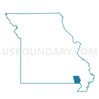
Outline

Summary
| Unique Area Identifier | 607281 |
| Name | Coon Island Voting District |
| County | Butler County |
| State | Missouri |
| Area (square miles) | 38.16 |
| Land Area (square miles) | 37.90 |
| Water Area (square miles) | 0.26 |
| % of Land Area | 99.31 |
| % of Water Area | 0.69 |
| Latitude of the Internal Point | 36.54973820 |
| Longtitude of the Internal Point | -90.41767820 |
Maps


Graphs
Select a template below for downloading or customizing gragh for Coon Island Voting District, Butler County, Missouri


Neighbors
Neighoring Voting District (by Name) Neighboring Voting District on the Map
- Bennett & Lemmons Voting District, Clay County, AR
- Cleveland & North Kilgore Voting District, Clay County, AR
- Neelyville Voting District, Butler County, MO
- Oglesville Voting District, Butler County, MO
- Qulin Voting District, Butler County, MO
- Sale Barn Voting District, Butler County, MO
Top 10 Neighboring County Subdivision (by Population) Neighboring County Subdivision on the Map
- Poplar Bluff township, Butler County, MO (25,878)
- Ash Hill township, Butler County, MO (3,349)
- Cleveland-North Kilgore township, Clay County, AR (2,665)
- Neely township, Butler County, MO (1,126)
- Gillis Bluff township, Butler County, MO (683)
- Bennett-Lemmons township, Clay County, AR (643)
- Coon Island township, Butler County, MO (187)
Top 10 Neighboring Unified School District (by Population) Neighboring Unified School District on the Map
- Corning Public Schools, AR (7,141)
- Twin Rivers R-X School District, MO (5,956)
- Neelyville R-IV School District, MO (3,822)
Top 10 Neighboring State Legislative District Lower Chamber (by Population) Neighboring State Legislative District Lower Chamber on the Map
- State House District 154, MO (36,484)
- State House District 163, MO (33,118)
- State House District 79, AR (24,175)
Top 10 Neighboring State Legislative District Upper Chamber (by Population) Neighboring State Legislative District Upper Chamber on the Map
Top 10 Neighboring 111th Congressional District (by Population) Neighboring 111th Congressional District on the Map
Top 10 Neighboring Census Tract (by Population) Neighboring Census Tract on the Map
- Census Tract 9506, Butler County, MO (4,287)
- Census Tract 9509, Butler County, MO (3,878)
- Census Tract 9503, Clay County, AR (2,204)